


THE SPATIAL INTELLIGENCE PLATFORM
From Site to Asset.
One Spatial Context for Everything You Own.
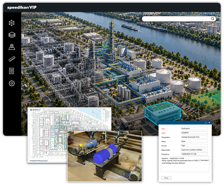
speedikon VIP brings CAD, BIM, point clouds, 2D plans and visual reality together in one browser-based spatial environment.
Navigate from the entire site to an individual asset – without replacing the systems your teams already use.


THE INFORMATION CHALLENGE
Large industrial sites rarely lack information. The problem is finding it in the context of the physical asset.
Plans, models, scans and technical information are distributed across engineering systems, document management, network drives and project folders.
Teams know the information exists – but often cannot find it, open it or understand how it relates to the asset in front of them.
THE POWER OF SPATIAL CONTEXT
Turn fragmented information into shared spatial understanding.
01.
Find by location, not filename
Navigate from site to building to asset – without knowing where the information is stored.
02.
Prepare before going on site
Understand conditions, access and surrounding infrastructure remotely.
03.
Compare design with reality
See models, plans, scans and visual reality in their physical relationship.
04.
Keep knowledge accessible
Preserve geometric information beyond individual projects, systems and employees.
ONE SPATIAL CONTEXT
From portfolio overview to asset-level insight.
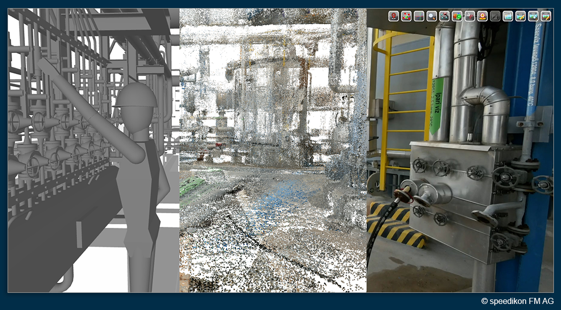
Cross-format spatial alignment
View CAD, BIM, point clouds, meshes and visual reality in their correct physical relationship.
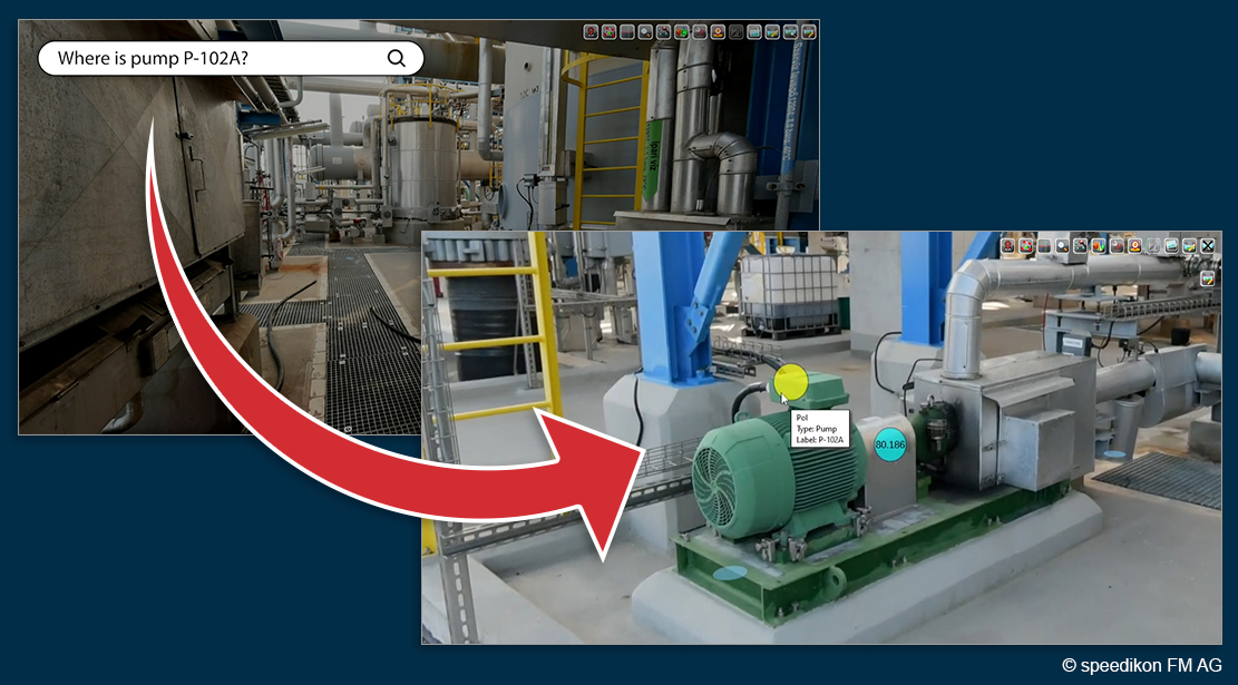
Portfolio and site overview
Navigate across sites, buildings, production areas and infrastructure within one spatial structure.
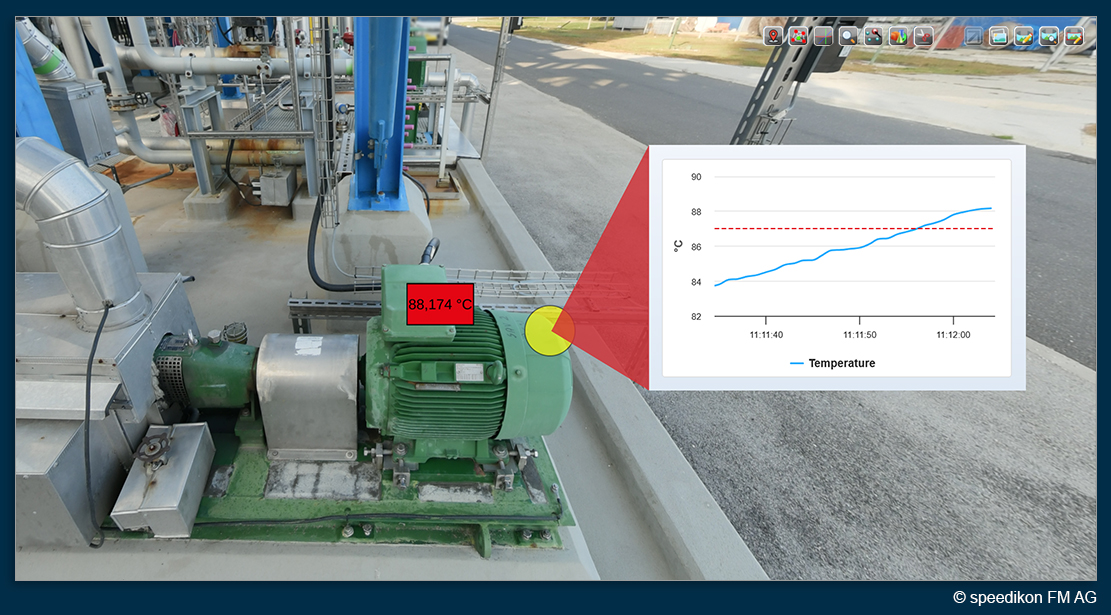
Coordinate-based navigation
Move directly from the wider site context to the relevant building, area or asset.
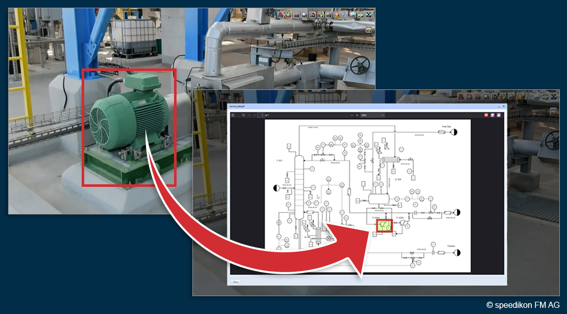
2D, 3D and reality in one location
Connect plans, technical diagrams and geometric representations to the physical environment they describe.
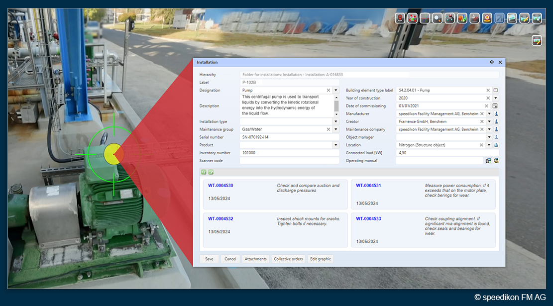
From geometry to authoritative information
Use the spatial context as the entry point to relevant asset information, documents and established enterprise systems.
THE GEOMETRIC DATA HUB
Different representations.
One physical reality.
A complex industrial site cannot be represented by one model alone. CAD and BIM, point clouds, meshes, 2D plans, photographs and GIS each capture different aspects of the same physical environment.
speedikon VIP brings these representations together in one shared spatial context – without requiring one perfect master model.


CONNECT WITH EXISTING SYSTEMS
Geometry is the operating context.
Every asset has a location. Every technical system occupies space. Every intervention takes place within a physical environment.
speedikon VIP uses this spatial context to make existing information easier to find, understand and apply.
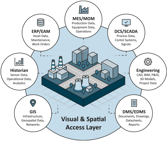
SAP, GIS, CAFM, DMS and engineering applications can remain authoritative for their respective information. VIP provides the visual and spatial access layer through which users can reach the information relevant to the physical location.
VIP does not need to become another system of record. It creates the shared context across the systems already in place.
SEE VIP IN ACTION
See how spatial context turns complex information into a clear operational view.
Explore how different geometries and data sources come together in one spatial environment – from the entire site down to individual assets.
BUILT FOR REAL ASSET OPERATIONS
Answer questions before they become problems.
Brownfield engineering
Understand existing conditions, compare design information with captured reality and identify spatial constraints before planning modifications.
Maintenance preparation
Review the physical environment, access conditions and infrastructure before work begins to improve preparation and reduce uncertainty.
Remote site access
Clarify questions about buildings, equipment and technical areas remotely, enabling informed decisions without requiring a site visit.
Site & infrastructure
Create a shared spatial overview of buildings, production areas, utilities and infrastructure networks to better understand complex sites.
Project collaboration
Give teams, planners and external partners access to the same spatial context for consistent collaboration and decision-making.
Knowledge retention
Preserve valuable site knowledge that would otherwise remain in specialist systems, personal folders or the experience of individual employees.
YOUR GEOMETRY. YOUR INFRASTRUCTURE. YOUR RULES.
Industrial accessibility without losing data control.
Geometry from production facilities, industrial sites and critical infrastructure can contain highly sensitive information. speedikon VIP can be deployed on-premises or within a controlled private-cloud environment and aligned with the organisation’s existing IT, access and security architecture.
Browser-based access does not require the uncontrolled distribution of source files or the installation of specialist applications throughout the organisation.


START WITH ONE SITE
Build a spatial foundation for your entire asset portfolio.
Bring one operational question and the geometric information you already own.
We will show you how speedikon VIP can make that information accessible – and how the same foundation can grow across sites, departments and use cases.